By default, Automatic Zooming is enabled, which means the viewport will automatically zoom and center over map resources displaying data.
For example, if you have data for France, the map will zoom and focus on the center of all the areas that are considered to be France. Your map default zoom may look like this:
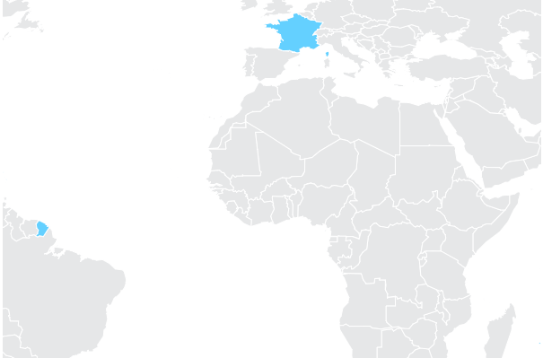
The reason for this, is because the automatic default zoom is also taking French Guiana, which is actually in South America as part of the data to consider when deciding where to center and zoom the map.
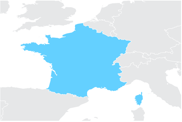
While French Guiana is indeed considered to be a part of France, in many cases you may want to just look at France mainland and hence center and zoom on that alone.
To do so, you can disable this behavior by setting the checkbox in the Properties panel and then using the mouse wheel or the zoom controls in view mode to set the default zoom level you need. This new zoom level will be then saved so every time you reload this visual, it will use your new zoom level.
You can also use the Default Viewport Center property to indicate the precise default position and zoom level of the viewport when Automatic Zooming is disabled.
To activate this option, click the plus under the Default Viewport Center option in the Properties panel. Indicate the X Value, Y Value, and Zoom Level, and then switch to View mode.
