I want to put a map on a dashboard of one US state and group the data by county, but I don’t see a way to do this. Is this even possible?
How do I add US counties to a map?
Hi Brandon - absolutely possible to have a state map grouped by county like you describe. You’ll need to bring in your own ESRI shapefile for this. Please see the video that i created on just this subject as i think that it will help you.
https://www.dundas.com/learning/theres-a-map-for-that
if you’re still having issues, come back to me and i’ll make sure you get what you need.
cheers
Hi Brandon,
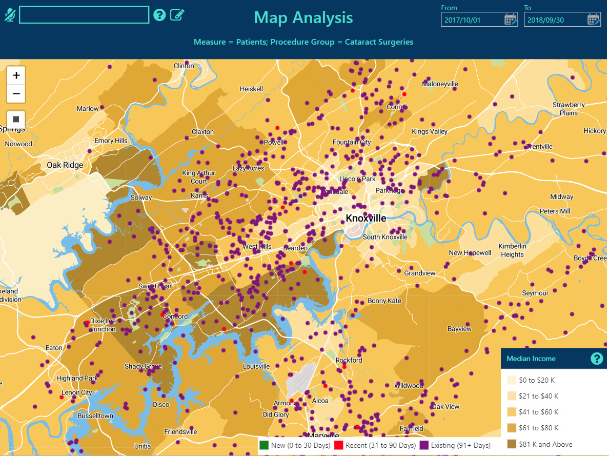
Jeff’s option is # 1. But if you’re trying to plot a lot of data, you may run into performance problems. If this happens to you, let us know and I’ll give you an alternative. In the map below, I’ve mapped out U.S. census tracts and then plotted patients on top of them. You can do this with Jeff’s solution, too. The difference is that I can plot 20,000 points in a few seconds, whereas I find the limit considerably less with the shapefile maps and built-in mechanisms.
Jeff, last thing I’d want to do is accidentally spread disinformation, so please feel free to correct me!
Wayne
HI Jeff - Found the shape file I needed and uploaded it with no problem. However, when I drag it over to a dashboard to add measures and dimensions, it just goes blank. I’ve spent the last 3 days trying to figure out the error, but I can’t determine what is causing the blank map. I have one measure and one dimension. The dimension being counties.
Additionally-
Here are the fields in my .dbf file that i added to my project.
Field | First value
----------±-----------------
ALAND | 1765640373
AWATER | 70634835
CBSAFP | ‘20500’
CLASSFP | ‘H1’
COUNTYFP | ‘037’
COUNTYNS | ‘01008544’
CSAFP | ‘450’
FUNCSTAT | ‘A’
GEOID | ‘37037’
INTPTLAT | ‘+35.7049939’
INTPTLON | ‘-079.2514542’
LSAD | ‘06’
METDIVFP | ‘’
MTFCC | ‘G4020’
NAME | ‘Chatham’
NAMELSAD | ‘Chatham County’
STATEFP | ‘37’
Hi Brandon,
i’ll put you in touch with one of our support people who can help you get to the bottom of this. In the past I’ve seen a few odd things like:
- shape files with messed up coordinate systems that don’t appear on the earth
- odd zoom settings
- unclosed paths
It could be a lot of things but they can help you
Jeff,
Thanks so much for all your help on this. I forgot to reply, but I wanted to let you know I got this solved using your support folks. Thanks again.
Excellent Brandon, thanks for following up. Would you mind posting the solution for anyone else reading this?
SOLUTION:
Google US counties DBF shape file.
Once you have your shape file, you can simply upload the shape file under “Maps” in the Explore Panel. Then add your measures and dimensions and it should work. However, if it doesn’t work-
Go to mapshaper.org and upload your shape file and you can edit the contents of the shape file so that you create a primary key within the shape file, whether that be county name, state, county number, etc.
1 Like